

Climate Information
Updated: February 20, 2026
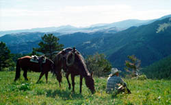
Montana's climate is shaped by big temperature swings, Chinook winds, and its mix of mountains and plains. The air is usually fairly dry, so heat and cold often feel less humid than in many other states. Average January temperatures on the plains and in valleys range from below about 12°F in the northeast to above 25°F in some south-central and far-western areas, while average July temperatures range from below about 64°F in higher western mountains to above 72°F in the southeastern plains. In many populated valleys, typical daytime highs are in the 30s in January and the 80s in July, with cool nights.
East-West Differences
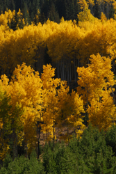
The Continental Divide splits Montana into two main climate regions. Western Montana, which is more influenced by Pacific air, generally has milder winters, cooler summers, and more evenly distributed precipitation throughout the year. Eastern Montana, farther from the ocean, tends to have hotter summer days, colder winter lows, stronger winds, and larger daily temperature swings, but it also usually has lower humidity and more sunny days on average. Elevations from about 1,800 to over 12,000 feet create additional local differences in temperature and snowfall.
Precipitation and Thunderstorms
Most of Montana's precipitation falls in late spring and early summer, especially from May through July. Some mountain areas see their peak in winter and spring because of heavy snow. On average, the state receives under 20 inches of precipitation per year, with western Montana often getting roughly twice as much moisture as the eastern plains. In July and August, brief afternoon thunderstorms are common; some bring heavy downpours and hail that can damage crops and buildings.
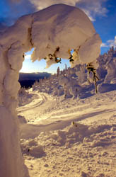
Snow and Chinook Winds
Annual snowfall varies widely. High mountain locations in western Montana can receive around 300 inches of snow each year, while some areas east of the Divide average only about 20 inches. Most larger cities see between 30 and 50 inches annually, with the heaviest snowfalls usually occurring from November through March, although early fall or late spring snowstorms can still happen at higher elevations.
Chinook winds are one of Montana's most dramatic weather features. These warm, dry winds blow down the east side of the Rockies and can raise temperatures 25 to 50 degrees during typical events, sometimes turning a cold winter day into a mild one within hours. In a few famous cases, Chinooks in Montana have produced some of the largest temperature jumps ever recorded in the United States.
Floods and Spring Runoff
In spring and early summer, melting mountain snowpack is the main source of water for many rivers and streams in Montana. When rapid snowmelt combines with heavy rain, rivers can swell and overflow, causing flooding in valleys and low-lying areas. Ice jams that form and then break up on rivers during the spring thaw can also lead to sudden, localized floods in some parts of the state.
Visit the Western Regional Climate Center's website for a detailed Montana climate summary.
Updated: February 2, 2026